UReader
Brands
Sign in
Sign up
Newsletter Search Engine
Dates
2025 (205704)
2026 (57867)
2024 (51094)
Business Categories
General
(100058)
Other
(57230)
Home
(21923)
Fashion
(20957)
Electronics
(16598)
Literature
(11197)
Sports
(11078)
Art
(8508)
Machinery
(5003)
Health
(4657)
Food
(2912)
Country
GLOBAL
(36253)
CO
(19578)
NL
(17213)
AU
(16763)
GB
(14851)
NZ
(14793)
US
(13536)
BE
(13153)
DE
(8903)
FI
(8574)
CL
(7656)
CA
(7445)
PL
(7305)
RO
(7137)
ES
(6748)
HU
(6493)
ZA
(6430)
IL
(5956)
AR
(5956)
DK
(5637)
FR
(5295)
SK
(5221)
BR
(5161)
HR
(5072)
IT
(4978)
CZ
(4651)
PT
(4486)
SE
(4464)
IE
(3839)
GR
(3814)
NO
(3783)
SG
(3136)
CH
(3049)
BG
(2914)
RU
(2612)
MY
(2279)
UA
(2255)
MX
(2153)
AT
(2123)
JP
(2119)
PE
(1848)
RS
(1765)
TR
(756)
VE
(751)
IO
(668)
ID
(590)
TW
(588)
PK
(576)
IQ
(542)
HK
(499)
MA
(476)
PH
(437)
TV
(409)
AE
(316)
TH
(249)
KW
(188)
KP
(108)
VN
(54)
EG
(42)
IN
(8)
KZ
(4)
MD
(2)
NU
(2)
LT
(1)
BA
(1)
LK
(1)
Total 314665 mails
bravojeans
AR
·
2026-6-12
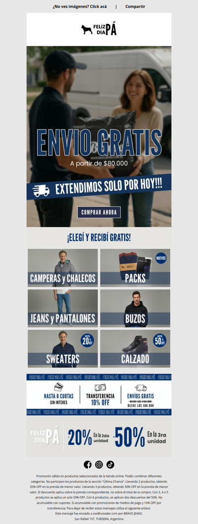
ENVIO GRATIS UN DÍA MÁS 💥
hartsofstur
GB
·
2026-6-12
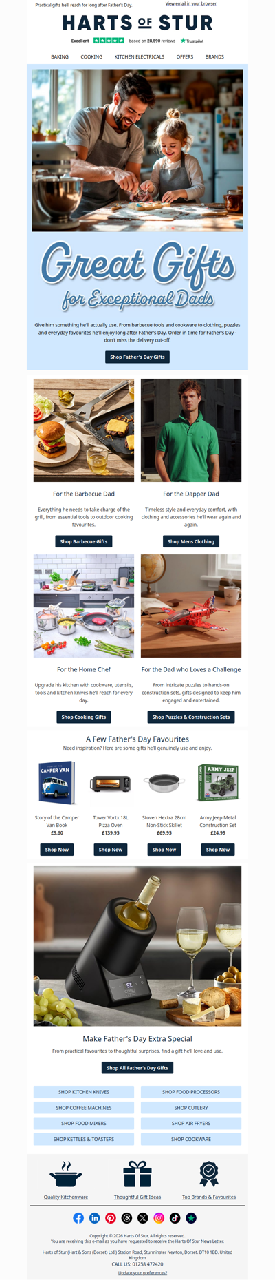
No Socks This Year. Just Proper Gifts.
cashbackkorting
NL
·
2026-6-12
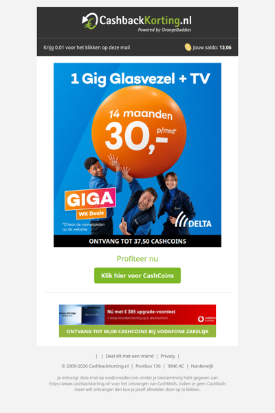
GIGA WK Deals: 14 maanden voor maar 30 EUR p.m.
poulpeo
FR
·
2026-6-12
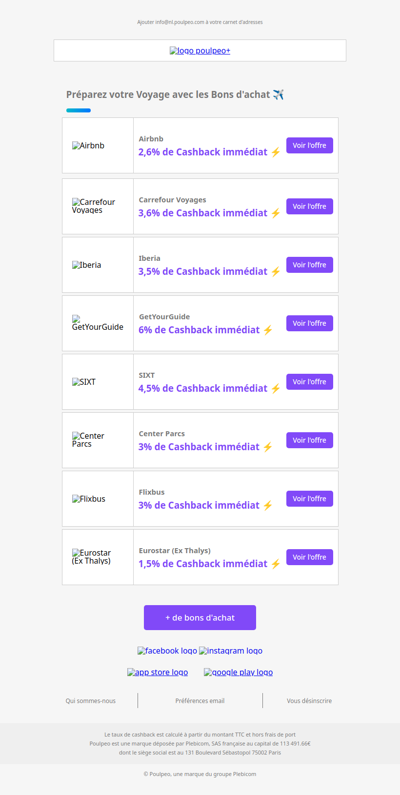
🧳 Vos envies de voyage prennent vie avec les Bons d'achat
usain
UA
·
2026-6-12
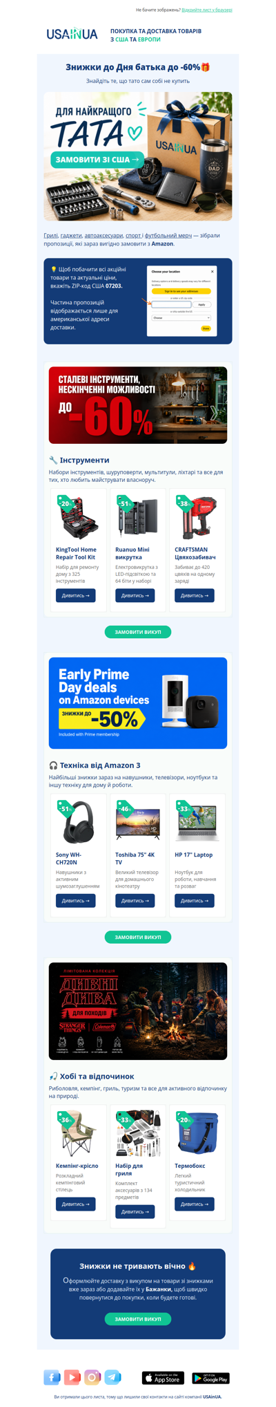
💙 Подарунки для тата зі знижками до -60%
dagaanbieding
NL
·
2026-6-12
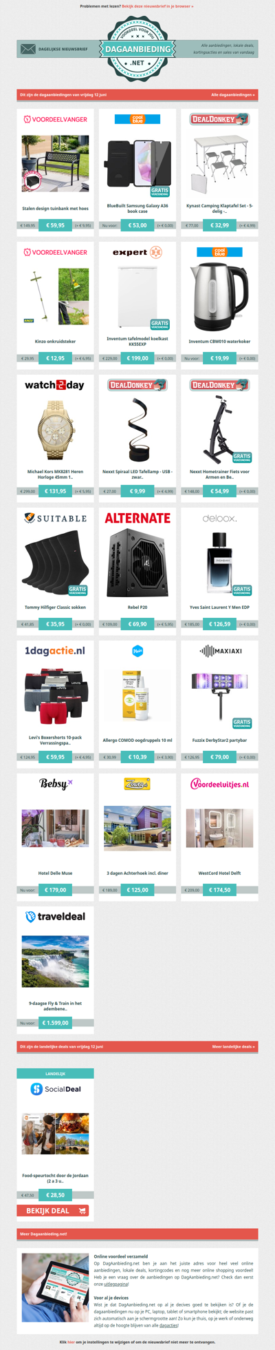
Beste Asda, alle dagaanbiedingen van vrijdag 12 juni
westelm
GLOBAL
·
2026-6-12
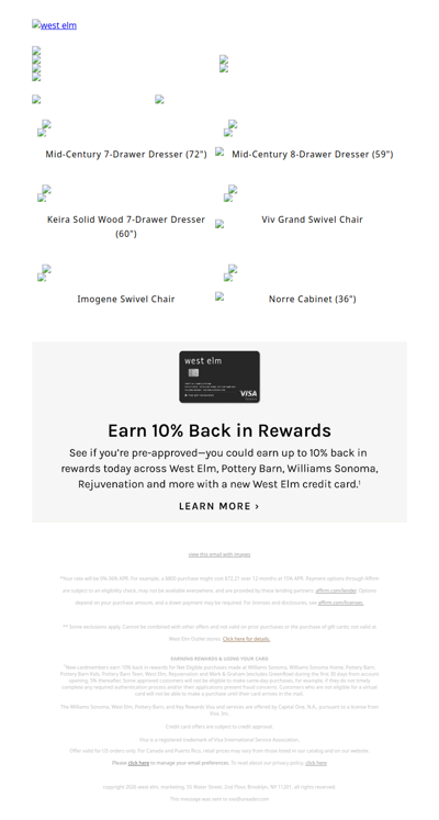
Give your greens the spotlight 🪴
jouwaanbieding
NL
·
2026-6-12
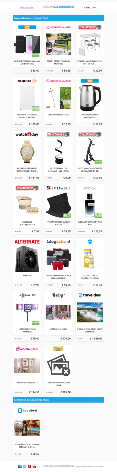
Alle dagaanbiedingen van vrijdag 12 juni
wannonce
GLOBAL
·
2026-6-12
Toutes les Circulaires du Québec sont ici !
smythstoys
GLOBAL
·
2026-6-12
Pre-Order NEW Games Just Announced!
catalogueza
ZA
·
2026-6-12
Latest Specials & Catalogues - 12.06.2026
us-eagle
FI
·
2026-6-12
Viikko Juhannukseen. Vielä voit varustautua😎
1
2
3
4
5
©2024 UReader
Home
Brands
Marked Emails
Followed Brands
Privacy Policy & User Agreement