UReader
Brands
Sign in
Sign up
Newsletter Search Engine
Dates
2025 (205704)
2026 (58327)
2024 (51094)
Business Categories
General
(100195)
Other
(57291)
Home
(21959)
Fashion
(20995)
Electronics
(16617)
Literature
(11208)
Sports
(11098)
Art
(8525)
Machinery
(5008)
Health
(4658)
Food
(2916)
Country
GLOBAL
(36322)
CO
(19583)
NL
(17232)
AU
(16793)
GB
(14874)
NZ
(14820)
US
(13562)
BE
(13166)
DE
(8912)
FI
(8583)
CL
(7668)
CA
(7457)
PL
(7315)
RO
(7142)
ES
(6751)
HU
(6503)
ZA
(6437)
AR
(5982)
IL
(5959)
DK
(5640)
FR
(5306)
SK
(5225)
BR
(5169)
HR
(5079)
IT
(4984)
CZ
(4654)
PT
(4492)
SE
(4471)
IE
(3850)
GR
(3823)
NO
(3787)
SG
(3142)
CH
(3053)
BG
(2918)
RU
(2619)
MY
(2285)
UA
(2260)
MX
(2164)
AT
(2127)
JP
(2120)
PE
(1849)
RS
(1771)
TR
(756)
VE
(752)
IO
(669)
ID
(590)
TW
(588)
PK
(577)
IQ
(543)
HK
(499)
MA
(476)
PH
(438)
TV
(409)
AE
(317)
TH
(251)
KW
(188)
KP
(108)
VN
(54)
EG
(42)
IN
(8)
KZ
(4)
MD
(2)
NU
(2)
LT
(1)
BA
(1)
LK
(1)
Total 315125 mails
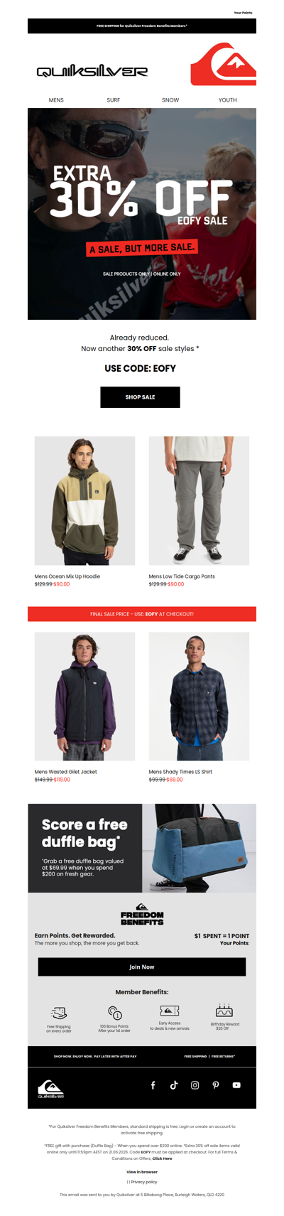
quiksilver
AU
·
2026-6-14
EOFY Just Turned Up a Notch 🔥
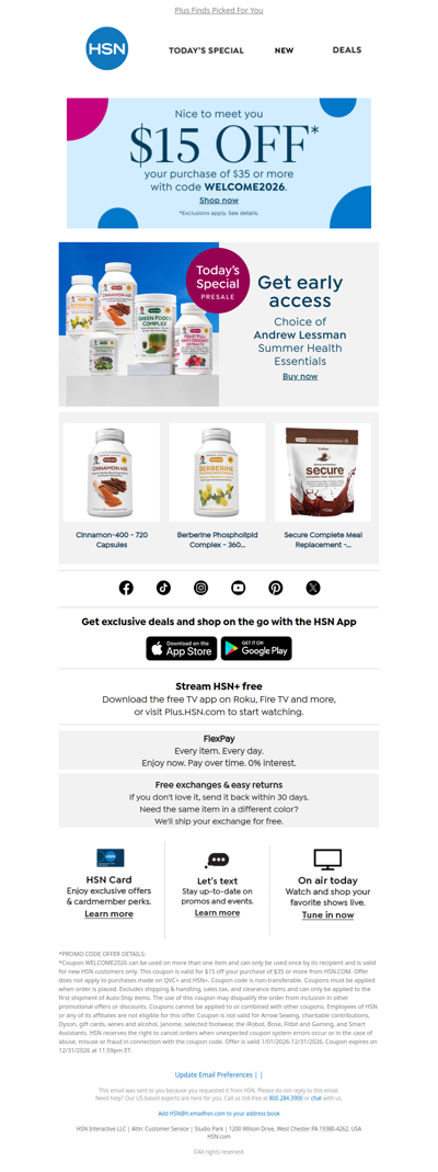
hsn
GLOBAL
·
2026-6-14
Andrew Lessman Presale Inside!
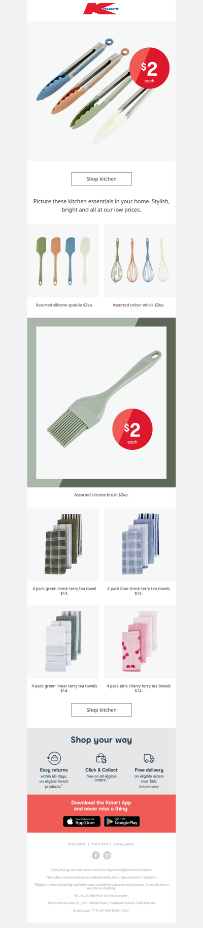
kmart
NZ
·
2026-6-14
Kitchen essentials from just $2
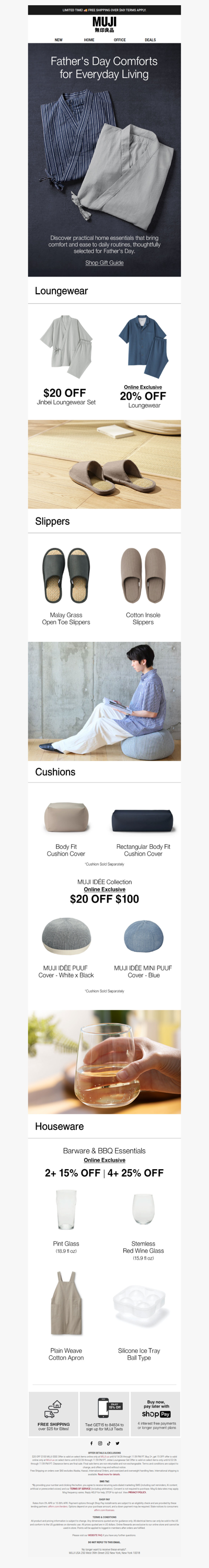
muji
US
·
2026-6-14
Comfort First, Grill Time Later 🔥
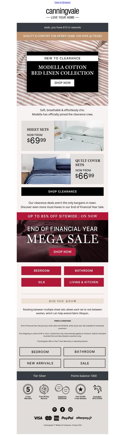
canningvale
GLOBAL
·
2026-6-14
Modella further markdowns are here...
tvsn
NZ
·
2026-6-14
Today's Special Offer
edisons
AU
·
2026-6-14
🧰The $119 Deal Every Workshop Needs
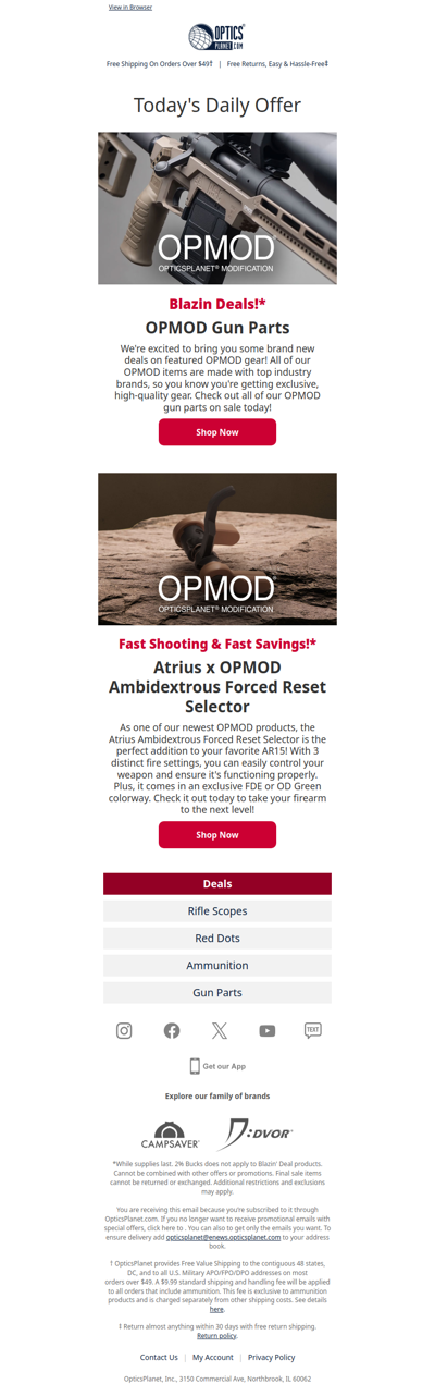
opticsplanet
GLOBAL
·
2026-6-14
New OPMOD Drops & Gun Part Deals!
colettehayman
AU
·
2026-6-14
Psst… the EOFY sale is still going 👀
retravision
AU
·
2026-6-14
LAST CHANCE: RAC Double Discount Weekend Ends TODAY!
itvsn
AU
·
2026-6-14
Today's Special Offer
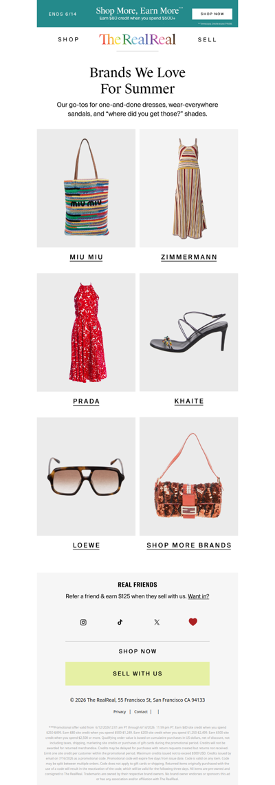
therealreal
GLOBAL
·
2026-6-14
Our five favorite brands this summer
1
2
3
4
5
©2024 UReader
Home
Brands
Marked Emails
Followed Brands
Privacy Policy & User Agreement