UReader
Brands
Sign in
Sign up
Newsletter Search Engine
Dates
2025 (205704)
2026 (60042)
2024 (51094)
Business Categories
General
(100698)
Other
(57557)
Home
(22106)
Fashion
(21131)
Electronics
(16709)
Literature
(11253)
Sports
(11174)
Art
(8576)
Machinery
(5022)
Health
(4673)
Food
(2934)
Country
GLOBAL
(36573)
CO
(19592)
NL
(17297)
AU
(16920)
GB
(14951)
NZ
(14918)
US
(13632)
BE
(13211)
DE
(8951)
FI
(8647)
CL
(7714)
CA
(7492)
PL
(7348)
RO
(7170)
ES
(6775)
HU
(6544)
ZA
(6476)
AR
(6043)
IL
(5981)
DK
(5666)
FR
(5339)
SK
(5252)
BR
(5193)
HR
(5110)
IT
(4999)
CZ
(4674)
PT
(4510)
SE
(4506)
IE
(3882)
GR
(3838)
NO
(3814)
SG
(3165)
CH
(3072)
BG
(2935)
RU
(2648)
MY
(2300)
UA
(2279)
MX
(2187)
AT
(2141)
JP
(2134)
PE
(1862)
RS
(1786)
TR
(760)
VE
(758)
IO
(674)
TW
(591)
ID
(590)
PK
(578)
IQ
(548)
HK
(500)
MA
(476)
PH
(443)
TV
(411)
AE
(320)
TH
(253)
KW
(188)
KP
(108)
VN
(54)
EG
(42)
IN
(8)
KZ
(4)
MD
(2)
NU
(2)
LT
(1)
BA
(1)
LK
(1)
Total 316840 mails
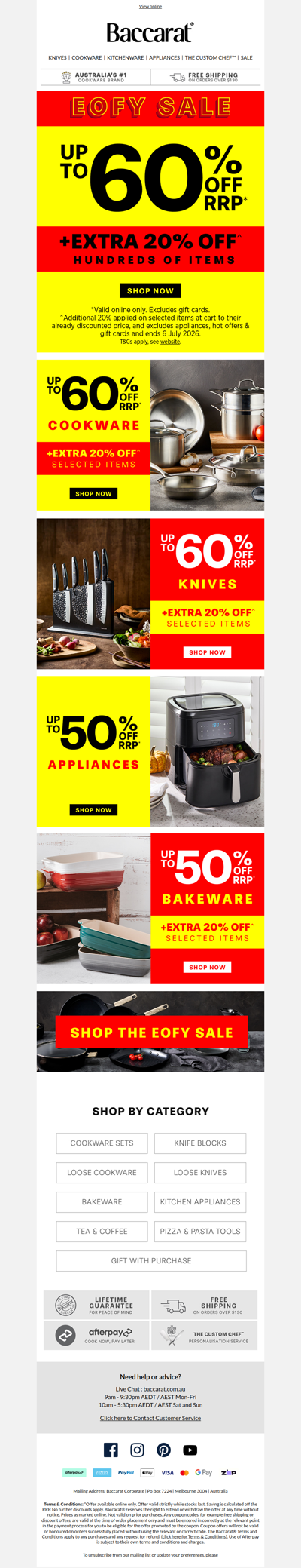
baccarat
AU
·
2026-6-19
Up to 60% OFF RRP + EXTRA 20% OFF Hundreds of items!
bradsdeals
US
·
2026-6-19
More Deals You’ll Love—Just for You!
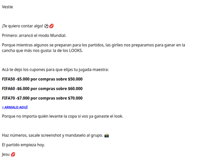
vestua
CL
·
2026-6-19
LLUVIA DE CUPONES!
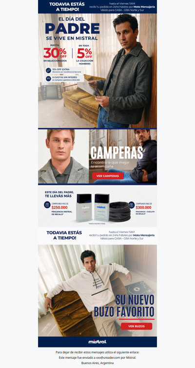
mistral
AR
·
2026-6-19
A tiempo para regalar el Domingo! ⏰
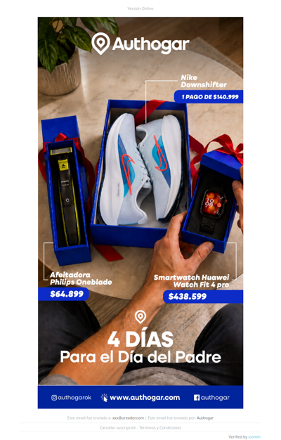
authogar
AR
·
2026-6-19
¡Faltan 4 Días para el día del Padre!
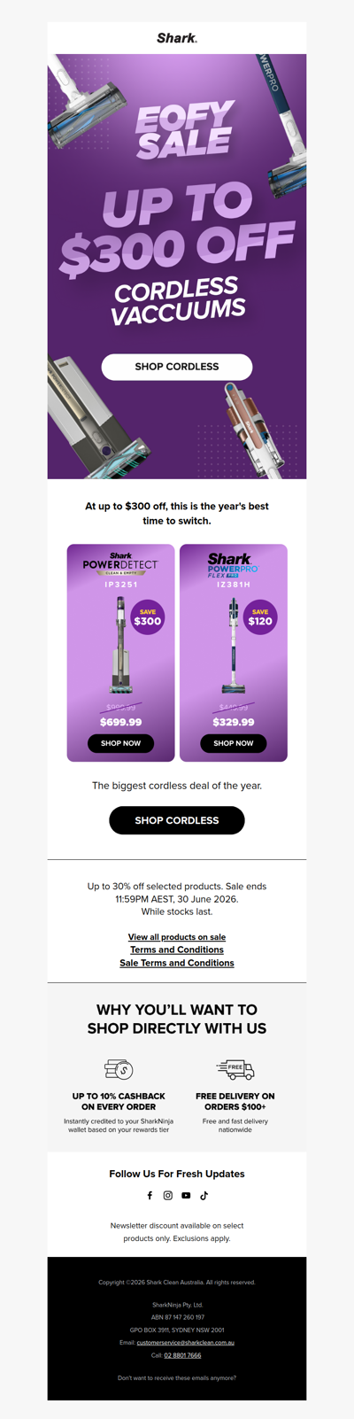
sharkclean
AU
·
2026-6-19
$300 off our smartest vac 🚨
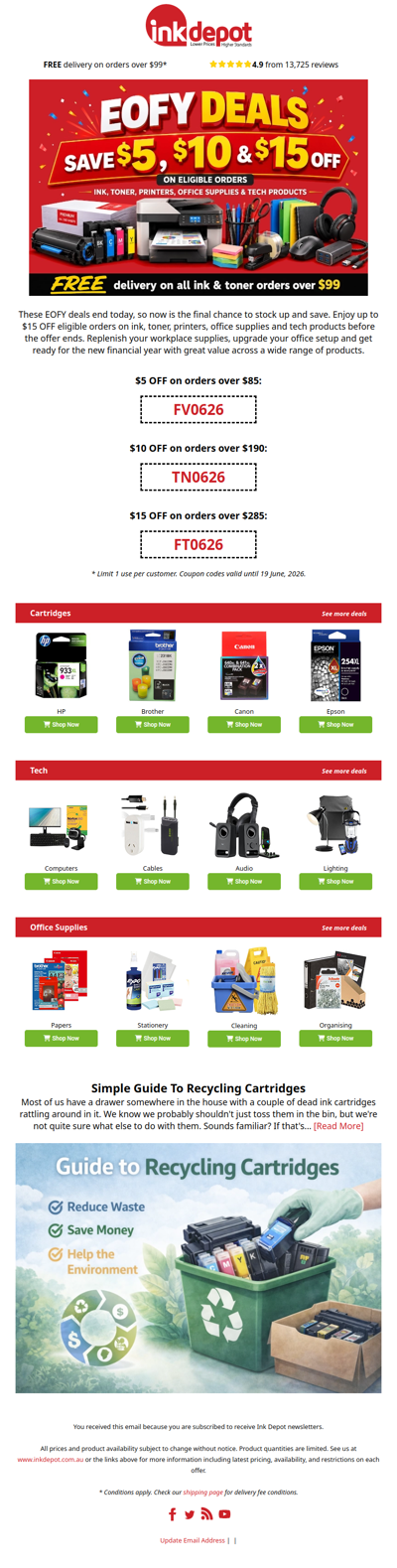
inkdepot
IO
·
2026-6-19
Last Chance - These Coupon Codes Expire At Midnight! ⏰
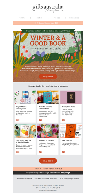
giftsaustralia
AU
·
2026-6-19
The only gift a book lover needs this winter
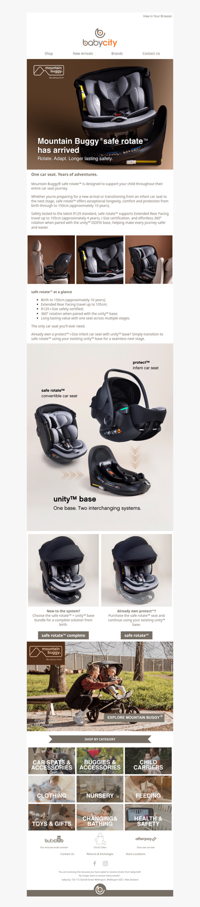
babycity
NZ
·
2026-6-19
safe rotate™, one seat for every stage
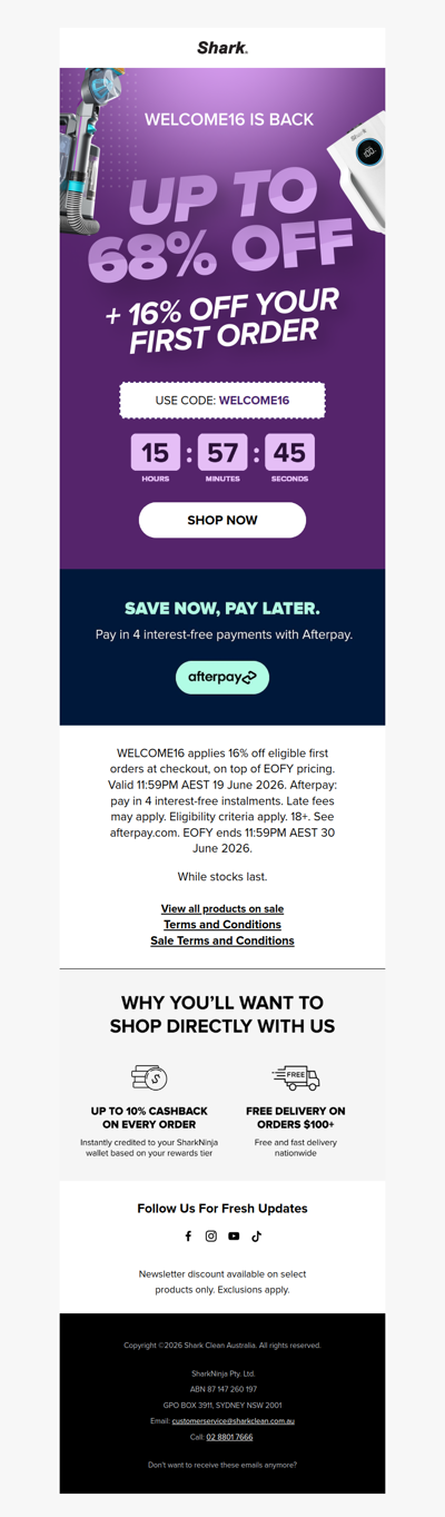
sharkclean
AU
·
2026-6-19
WELCOME16 is back, today only 🦈
mytopia
AU
·
2026-6-19
🚨 Friday Deals + Extra 10% Off
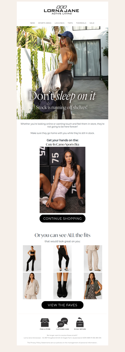
lornajane
AU
·
2026-6-19
Snap Up The New Fits (Before Everyone Else Does)! ⏰
1
2
3
4
5
©2024 UReader
Home
Brands
Marked Emails
Followed Brands
Privacy Policy & User Agreement