UReader
Brands
Sign in
Sign up
Newsletter Search Engine
Dates
2025 (205704)
2026 (61176)
2024 (51094)
Business Categories
General
(101037)
Other
(57718)
Home
(22205)
Fashion
(21219)
Electronics
(16757)
Literature
(11286)
Sports
(11228)
Art
(8608)
Machinery
(5031)
Health
(4682)
Food
(2944)
Country
GLOBAL
(36738)
CO
(19597)
NL
(17345)
AU
(17009)
GB
(14998)
NZ
(14996)
US
(13678)
BE
(13243)
DE
(8982)
FI
(8686)
CL
(7744)
CA
(7517)
PL
(7370)
RO
(7192)
ES
(6791)
HU
(6566)
ZA
(6502)
AR
(6083)
IL
(5995)
DK
(5680)
FR
(5363)
SK
(5260)
BR
(5209)
HR
(5133)
IT
(5011)
CZ
(4687)
SE
(4524)
PT
(4522)
IE
(3906)
GR
(3847)
NO
(3831)
SG
(3179)
CH
(3094)
BG
(2945)
RU
(2660)
MY
(2312)
UA
(2289)
MX
(2198)
AT
(2150)
JP
(2142)
PE
(1866)
RS
(1797)
TR
(764)
VE
(760)
IO
(676)
TW
(593)
ID
(590)
PK
(579)
IQ
(550)
HK
(500)
MA
(476)
PH
(448)
TV
(413)
AE
(322)
TH
(255)
KW
(188)
KP
(108)
VN
(54)
EG
(42)
IN
(8)
KZ
(4)
MD
(2)
NU
(2)
LT
(1)
BA
(1)
LK
(1)
Total 317974 mails
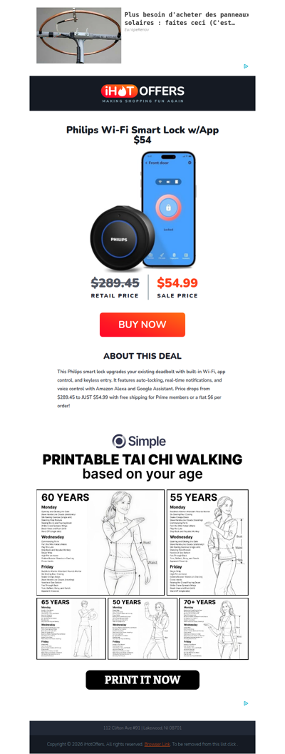
ihotoffers
GLOBAL
·
2026-6-22
Philips Retrofit Wi-Fi Smart Lock - $54
walmart
CA
·
2026-6-22
OMG! Walmart Deals launched! 🥳
fromjapan
JP
·
2026-6-22
【最高20%优惠】仅限24小时 Rakuten Rakuma9折活动实施中!+即将结束!10% FJ 点数回馈进行中 [FJ]
easy
AR
·
2026-6-22
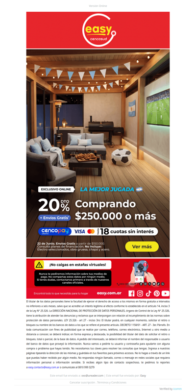
¡Aprovechar esta promo es tu mejor jugada! Hasta 20% y 18 CSI
westelm
GLOBAL
·
2026-6-22
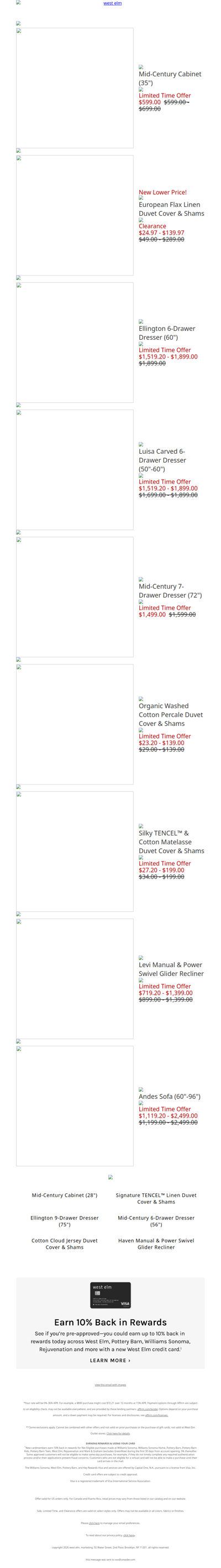
Mid-Century Cabinet (35") is on *sale* but going fast
tramontina
AR
·
2026-6-22
⚽ Prepará la previa. El regalo va por nuestra cuenta. 🎁
weekendesk
FR
·
2026-6-22
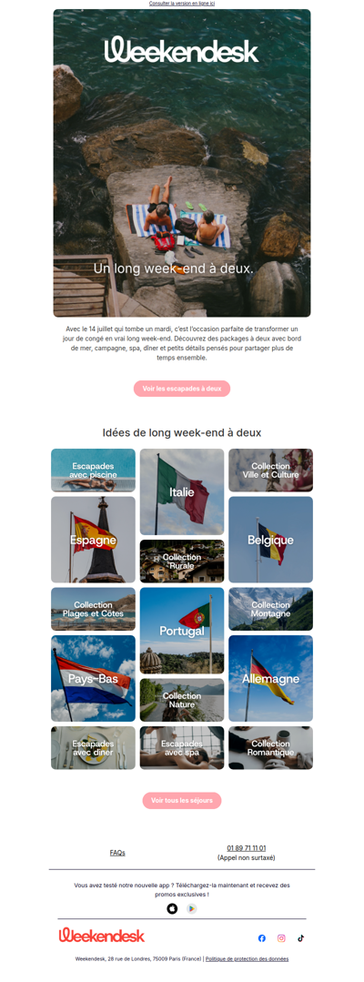
Une escapade à deux pour le 14 juillet
yazbek
MX
·
2026-6-22
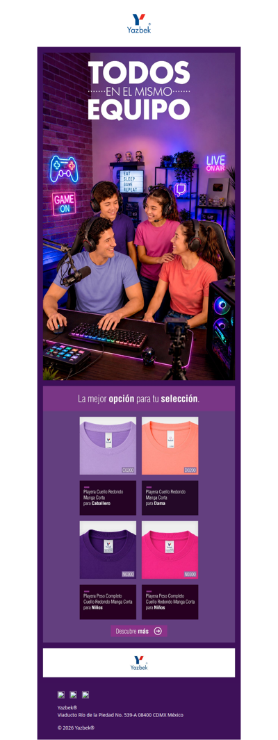
Para jugar, crear y compartir, la comodidad también cuenta.Elige Yazbek.
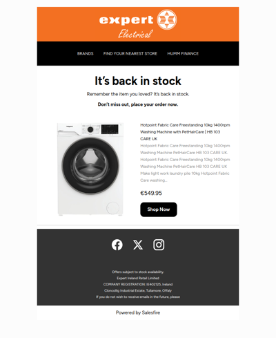
expert
IE
·
2026-6-22
Your item is back in stock
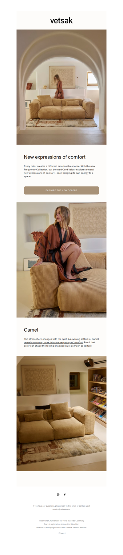
vetsak
ZA
·
2026-6-22
Cord Velour: discover the new colors.
andesgear
CL
·
2026-6-22
Partieron los Andes Days - hasta 50% OFF🔥
santil
BR
·
2026-6-22
FRETE GRÁTIS PARA TODO O BRASIL. Aproveite agora!
1
2
3
4
5
©2024 UReader
Home
Brands
Marked Emails
Followed Brands
Privacy Policy & User Agreement

![【最高20%优惠】仅限24小时 Rakuten Rakuma9折活动实施中!+即将结束!10% FJ 点数回馈进行中 [FJ]](https://api.ureader.com/mail/thumbnail/fromjapan.co.jp/1782140813063/最高20-优惠-仅限24小时-rakuten-rakuma9折活动实施中-即将结束-10-fj-点数回馈进行中-fj.webp)