UReader
Brands
Sign in
Sign up
Newsletter Search Engine
Dates
2025 (205704)
2026 (61587)
2024 (51094)
Business Categories
General
(101161)
Other
(57798)
Home
(22235)
Fashion
(21245)
Electronics
(16783)
Literature
(11294)
Sports
(11241)
Art
(8620)
Machinery
(5034)
Health
(4688)
Food
(2948)
Country
GLOBAL
(36797)
CO
(19599)
NL
(17361)
AU
(17031)
GB
(15020)
NZ
(15011)
US
(13703)
BE
(13255)
DE
(8991)
FI
(8695)
CL
(7752)
CA
(7528)
PL
(7381)
RO
(7197)
ES
(6797)
HU
(6572)
ZA
(6513)
AR
(6102)
IL
(5999)
DK
(5685)
FR
(5368)
SK
(5269)
BR
(5217)
HR
(5139)
IT
(5015)
CZ
(4692)
PT
(4532)
SE
(4531)
IE
(3918)
GR
(3850)
NO
(3838)
SG
(3185)
CH
(3098)
BG
(2949)
RU
(2664)
MY
(2316)
UA
(2292)
MX
(2205)
AT
(2155)
JP
(2144)
PE
(1869)
RS
(1803)
TR
(765)
VE
(763)
IO
(677)
TW
(593)
ID
(590)
PK
(579)
IQ
(552)
HK
(500)
MA
(476)
PH
(449)
TV
(414)
AE
(323)
TH
(255)
KW
(188)
KP
(108)
VN
(54)
EG
(42)
IN
(8)
KZ
(4)
MD
(2)
NU
(2)
LT
(1)
BA
(1)
LK
(1)
Total 318385 mails
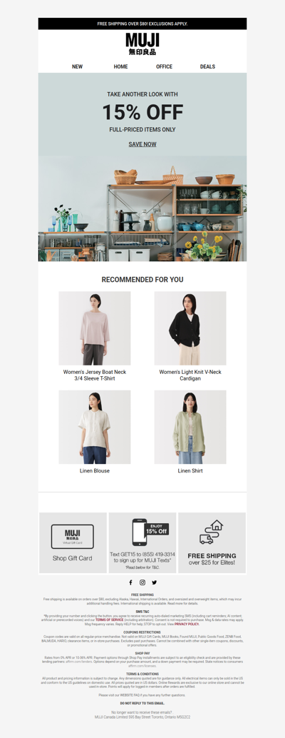
muji
CA
·
2026-6-24
15% Off Is Leaving Soon
musthaveideas
GB
·
2026-6-24
HURRY! Ends At Full Time ⚽
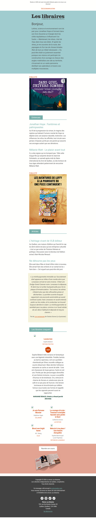
leslibraires
CA
·
2026-6-24
Revue Les libraires - Votre infolettre
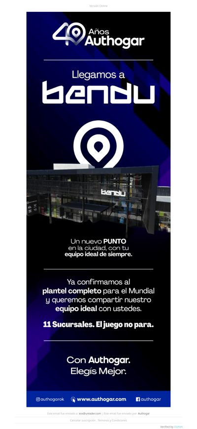
authogar
AR
·
2026-6-24
¡Completamos el plantel!
dansdeals
GLOBAL
·
2026-6-24
DansDeals Daily Digest for 06/23/2026
gotta
CL
·
2026-6-24
🔥 Noche de San Juan: tu cupón ritual te espera
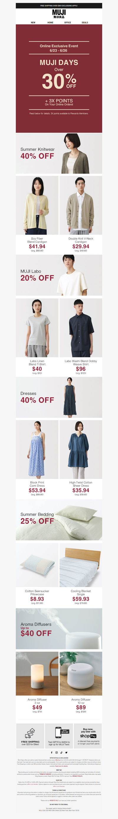
muji
US
·
2026-6-24
MUJI Days Is Back With Over 30% Off! 📣
freestufffinder
VE
·
2026-6-24
🔥 Hot Prime Deals Just for You!!
dolce-gusto
AR
·
2026-6-24
¡Aprovechá esta promo mundial! 50% OFF en cápsulas ☕
meh
US
·
2026-6-24
Weirdly welcome
mgl
BR
·
2026-6-24
Todas as Novidades da semana!! Confira agora e de o seu LANCE!!!!
bidspotter
CA
·
2026-6-24
Upcoming BidSpotter Auctions - Don't Miss Out
1
2
3
4
5
©2024 UReader
Home
Brands
Marked Emails
Followed Brands
Privacy Policy & User Agreement